 Terrestrial Volcanoes
 Terrestrial Volcanoes

Composite volcanoes in chains such as the Cascade Mountains, erupt less frequently but usually with more explosive violence. Eruptions may come along only decades apart, but not always from the same volcano. Individual active volcanoes can be dormant for a few hundred years at a time. Mount St. Helens has erupted approximately every 100 to 150 years or so since 1400 A.D. Mount Lassen erupted in 1915. Crater Lake formed in a gigantic cataclysmic eruption about 5000 B.C. Mount Baker showed increased activity in the 1970's. Warm spots and steam rise in the summit areas of Mount Rainier, Mount Shasta and Mount Hood. Any one of those Cascades volcanoes could turn deadly as did Mount St. Helens in 1980.
Even though individual volcanoes are different, they can be grouped into a few families according to shape, size, and types of volcanic material. Probing a bit deeper, volcanologists have learned that the composition of the original magma, or mixing with surface water, are the principal reasons for similarities and differences. Volcanoes within each family may resemble one another but they differ in physical details and behavior. It is not easy to predict eruptive behavior until the behavior has been witnessed or determined by examining the resulting deposits.
Mount St. Helens and Mount Rainier are typical of the graceful solitary cones known as composite cones (or stratovolcanoes) with slopes made of innumerable pyroclastic layers interspersed with lava flows. Some attain two to three thousand meters (six to eight thousand feet) above their bases. Depending upon latitude, seasonal winter snows whiten the slopes to the base, and the heat of summer melts all but the highest snows. On the upper slopes of some volcanoes, such as Mount Rainier, the perennial snows spawn glaciers that descend for many miles as rivers of ice.
Most composite cones occur alone or are separated by several tens of kilometers, some of the most majestic in the world forming a chain down the backbone of the Cascade Mountains of British Columbia, Washington, Oregon, and northern California, and continuing around the Pacific in the "Ring of Fire." Composite volcanoes are constructed from multiple eruptions, sometimes over hundreds of thousands of years, sometimes over a few hundred. Andesite magma, the most common, but not the only magma type forming composite cones, is more explosive than basalt magma because it contains more silica, but also produces lava flows. The explosive eruptions provide abundant pyroclastic debris in the stratocones. But, not all of the magma rises to the summit. Some of it penetrates pyroclastic layers of the volcano to form dikes (sheetlike bodies of intrusive rock) or sills (intrusive rock that parallels the boundary between two rock layers). In this way, multiple intrusive events build a structurally strong three-dimensional dike-and-sill network that knits together the voluminous accumulation of volcanic ash, sediment and lava flows. Composite cones can therefore grow to great heights before collapsing under the weight of the Earth's gravitational field as happened at Mount St. Helens.
On the outside slopes of composite cones or inside their craters there are dome-like protrusions. Lava domes result from the slow extrusion of highly viscous silica-rich magma. Most domes are rather small, but some have volumes exceeding 25 cubic kilometers. Although they end up as rather benign eruptions, dome-producing eruptions may start very explosively, forming reamed-out pits blanketed by pyroclastic debris. The explosive activity wanes as the gas content decreases and the magma is extruded slowly as rhyolite lava that is so viscous it only forms a bulbous dome. If extrusions continue, the dome enlarges and its margins slowly creep outward as a lava flow with steep cliff-like margins and a rubbly surface. The steep dome fronts can collapse in a dangerous mass of hot rubble that can form pyroclastic flows .
Domes can be solitary volcanoes, form in clusters, grow in craters or along the flanks of composite cones. A dome has been growing slowly within the crater of Mount St. Helens since the eruption of 1980. Domes have also filled the crater of Mt. Pelee, Martinique, and many other volcanoes.
In the jargon of some volcanologists a volcanic eruption is divided into
Individual volcanoes may erupt for a short time once every thousand years, but we are most concerned with eruptions on a human time scale of weeks, months or years. On this scale, some eruptions last a very long time. Stromboli, Italy, the "lighthouse of the Mediterranean" has been erupting for over 2500 years. Some eruptions are exceedingly short, with 10 percent lasting no longer than a single day, most ending in less than 100 days, and a few lasting longer than 1000 days. The average duration of recorded eruptions at Stromboli is 7 weeks.
History's most damaging eruption occurred in 1815. Tambora volcano, Indonesia, experienced 3 years of mild activity, lulling the people into complacency. But following the mild activity, Tambora violently exploded with an eruption cloud that reached 44 kilometers. Pumice and volcanic ash amounting to 100 to 300 cubic kilometers were ejected -- the largest known eruption in history and one that caused famine and serious economic repercussions in Europe.
 Movies of Volcanoes
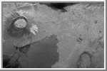 Isla Isabella
(GIF 1M,
caption)
This is an image showing part of Isla Isabella in the western
Galapagos Islands.
The western Galapagos Islands, which lie about 1,200 kilometers
(750 miles) west of Ecuador in the eastern Pacific, have six
active volcanoes similar to the volcanoes found in Hawaii
and reflect the volcanic processes that occur where the
ocean floor is created. Since
the time of Charles Darwin's visit to the area in 1835, there
have been over 60 recorded eruptions on these volcanoes. This
SIR-C/X-SAR image of Alcedo and Sierra Negra volcanoes shows the
rougher lava flows as bright features, while
ash deposits and
smooth pahoehoe lava flows appear dark. A small portion of Isla
Fernandina is visible in the extreme upper left corner of the
image. (Courtesy NASA/JPL).
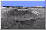 Isla Isabella in 3D
(GIF, 165K;
JPG, 692K;
caption)
This is a three-dimensional view of Isabela, one of the Galapagos
Islands located off the western coast of Ecuador, South America.
(Courtesy NASA/JPL).
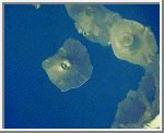 Galapagos Islands
(GIF, 200K)
This image of the Galapagos Islands was taken from the space shuttle
using a hand held camera. There are seven
shield volcanoes in this
area (Fernandina, Ecuador, Wolf, Darwin, Alcedo, Sierra Negra, and Azul)
which collectively have erupted more than sixty times this century.
Unlike Hawaii, these volcanoes are infrequently studied due to their
inaccessibility and delicate ecology. In addition, the rugged terrain,
lack of water and field support make these volcanoes difficult to
map and study in the field. (Courtesy NASA/JPL).
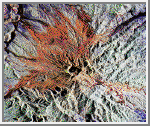 Mount Pinatubo
(GIF, 286K;
JPG, 3M;
caption)
This is a false color image of the area around
Mount Pinatubo in the Philippines. The area shown is
approximately 45 by 68 kilometers (28 by 42 miles). The main
volcanic crater on Mount Pinatubo produced by the June 1991
eruptions, and the steep slopes on the upper flanks of the
volcano, are easily seen in this image. The red color on the
high slopes show the rougher
ash deposited during the 1991
eruption. The dark drainages are the smooth mudflows which
continue to flood the river valleys after heavy rain.
The 1991 eruption of Mount Pinatubo in the Philippines is well known for its near-global effects on the atmosphere and climate due to the large amount of sulfur dioxide that was injected into the upper atmosphere. What is less widely known is that even today the volcano continues to be a major hazard to the people who have returned to the area around the volcano. Dangerous mudflows (called "lahars") are often generated by heavy rains, and these can still sweep down river valleys and wash out roads and villages, or bury low lying areas in several meters of mud and volcanic debris. These mudflows will continue to be a severe hazard around Pinatubo for the next 10 to 15 years. (Courtesy NASA/JPL).
 Virunga Volcano Chain
(GIF, 246K;
JPG 2M;
caption)
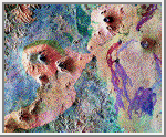
This is a false-color radar image of Central Africa, showing
the Virunga volcano chain along the borders of Rwanda, Zaire
and Uganda. This area is home to the endangered mountain
gorillas. The image was acquired on October 3, 1994.
The dark area at the top of the image is
Lake Kivu, which forms the border between Zaire (to the
right) and Rwanda (to the left). In the center of the image
is the steep cone of Nyiragongo volcano, rising 3,465 meters
(11,369 feet) high, with its central crater now occupied by
a lava lake. To the left are three volcanoes, Mount
Karisimbi, rising 4,500 meters (14,800 feet) high; Mount
Sabinyo, rising 3,600 meters (12,000 feet) high; and Mount
Muhavura, rising 4,100 meters (13,500 feet) high. To their
right is Nyamuragira volcano, which is 3,053 meters (10,017
feet) tall, with radiating lava flows dating from the 1950s
to the late 1980s. These active volcanoes constitute a
hazard to the towns of Goma, Zaire and the nearby Rwandan
refugee camps, located on the shore of Lake Kivu at the top
left. (Courtesy NASA/JPL).
 Mount Rainier
(GIF, 308K;
JPG, 2M;
caption)
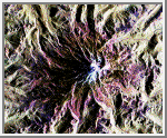
This is a radar image of Mount Rainier in Washington state. The
volcano last erupted about 150 years ago and numerous large
floods and debris flows have originated on its slopes during the
last century. Today the volcano is heavily mantled with glaciers
and snowfields. More than 100,000 people live on young volcanic
mudflows less than 10,000 years old and, consequently, are
within the range of future, devastating mudslides.
North is toward the top left of the image.
Forested regions are pale green in color; clear cuts and bare
ground are bluish or purple; ice is dark green and white. The
round cone at the center of the image is the 14,435-foot (4,399-
meter) active volcano, Mount Rainier. On the lower slopes is a
zone of rock ridges and rubble (purple to reddish) above
coniferous forests (in yellow/green).
(Courtesy NASA/JPL).
 Kliuchevskio Volcano
(GIF, 291K;
JPG, 408K;
caption)
This is an image of the area of Kliuchevskoi volcano,
Kamchatka, Russia, which began to erupt on September 30,
1994. Kliuchevskoi is the blue triangular peak in the
center of the image, towards the left edge of the bright red
area that delineates bare snow cover.
The image was acquired on October 5, 1994. It
shows an area approximately 75 kilometers by 100 kilometers
(46 miles by 62 miles) that is centered at 56.07 degrees
north latitude and 160.84 degrees east longitude. North is
toward the bottom of the image. The Kamchatka volcanoes are
among the most active volcanoes in the world. The volcanic
zone sits above a tectonic plate boundary, where the Pacific
plate is sinking beneath the northeast edge of the Eurasian
plate. In addition to Kliuchevskoi, two other active volcanoes are
visible in the image. Bezymianny, the circular crater above
and to the right of Kliuchevskoi, contains a slowly growing
lava dome. Tolbachik is the large volcano with a dark
summit crater near the upper right edge of the red snow
covered area. The Kamchatka River runs from right to left
across the bottom of the image. The current eruption of
Kliuchevskoi included massive ejections of gas, vapor and
ash, which reached altitudes of 15,000 meters (50,000 feet).
Melting snow mixed with volcanic ash triggered mudflows on
the flanks of the volcano. Paths of these flows can be seen
as thin lines in various shades of blue and green on the
north flank in the center of the image.
(Courtesy NASA/JPL).
 Unzen Volcano, Japan
(GIF, 269K;
TIFF, 25M;
caption)
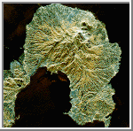
This is a space radar image of the area around the Unzen
volcano, on the west coast of Kyushu Island in southwestern
Japan. Unzen, which appears in this image as a large
triangular peak with a white flank near the center of the
peninsula, has been continuously active since a series of
powerful eruptions began in 1991. The image was acquired
on April 15, 1994. The image shows an area
41.5 kilometers by 32.8 kilometers (25.7 miles by 20.3
miles) that is centered at 32.75 degrees north latitude and
130.15 degrees east longitude. North is toward the upper
left of the image.
The city of Shimabara sits along the coast at the foot of
Unzen on its east and northeast sides. At the summit of
Unzen a dome of thick lava has been growing continuously
since 1991. Collapses of the sides of this dome have
generated deadly avalanches of hot gas and rock known as
pyroclastic flows.
(Courtesy NASA/JPL).

Carr M. H. and Greeley R. Volcanic Features of Hawaii: A Basis for Comparison with Mars. NASA SP-403, 1980.
Cattermole P. Planetary Volcanism. Ellis Horwood, Chichester, England.
Decker R. W. and Decker B. B. Mountains of Fire. Cambridge University, New York, 1991.
McDonald G. A., Abbott A. T., and Peterson F. L. Volcanos in the Sea. University of Hawaii, Honolulu, 1986.
Mouginis-Mark, Peter. Volcanic Features of Hawaii and Other Worlds. Lunar and Planetary Institute, slide set.

